
Data collection
Scaling
So that each model has its real size and the zones line up with each other (see Aligning chunks), I measure distances on the site during the dives: two targets placed on the bottom, the distance between them measured, and both targets filmed with the rest of the zone. The distance between two targets makes a scale.
Targets7.5 and 15 cm
Kindcoded, Metashape
In pairstargets 1 and 2
The targets
Section titled “The targets”Targets of 7.5 cm and 15 cm, numbered in pairs (targets 1 and 2).
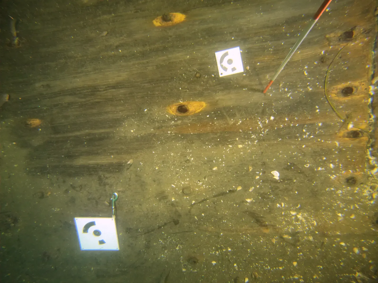
Their pattern looks abstract, but each one carries a coded number. They are Metashape’s circular coded targets: the black dot in the centre marks the exact point to measure, and the black sectors of the ring around it make the code, each position on the ring a binary digit, black or white. Metashape reads that ring in the photos, recognises each target’s number and finds the same target from one photo to the next.
(to be completed: how the targets are printed and protected, how the distance is measured underwater.)
In Metashape, the targets are detected in the photos and the scales defined with the measured lengths: the column “Targets detected / Scale(s) defined” of the progress by zone.
(to be completed: the steps in Metashape.)