
About Lock 21
Lock 21 lies under 60 feet (18.3 m) of water in the St. Lawrence, near Long Sault, Ontario. The tops of the piers are at 40 feet (12 m). The current is strong: in the lock I measured about 35 feet per minute (10.7 m/min) in June 2024; it is stronger over the spillway.
Depth60 ft (18.3 m)
Tops of the piers40 ft (12 m)
Chamber270 × 45 ft
Rebuilt1883–1886
FloodedJuly 1, 1958
Lock 21 was the last lock of the Cornwall Canal, at its upstream head, at the village of Dickinson’s Landing. The canal, opened in the early 1840s, bypassed the Long Sault rapids from Cornwall to Dickinson’s Landing, over about 11 miles.
It was a guard lock: no difference in level between upstream and downstream. The one we dive today dates from the canal’s enlargement, rebuilt from 1883 to 1886: a chamber 270 feet by 45 (82 m by 14 m), and a spillway at its upstream end.
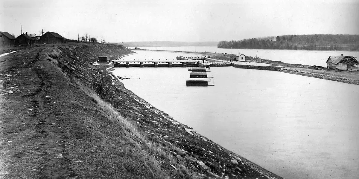
On July 1, 1958, the Robert H. Saunders dam, built for the St. Lawrence Seaway, flooded the lock, Dickinson’s Landing and other villages along the shore: the Lost Villages. Their people had been moved to Long Sault and Ingleside.
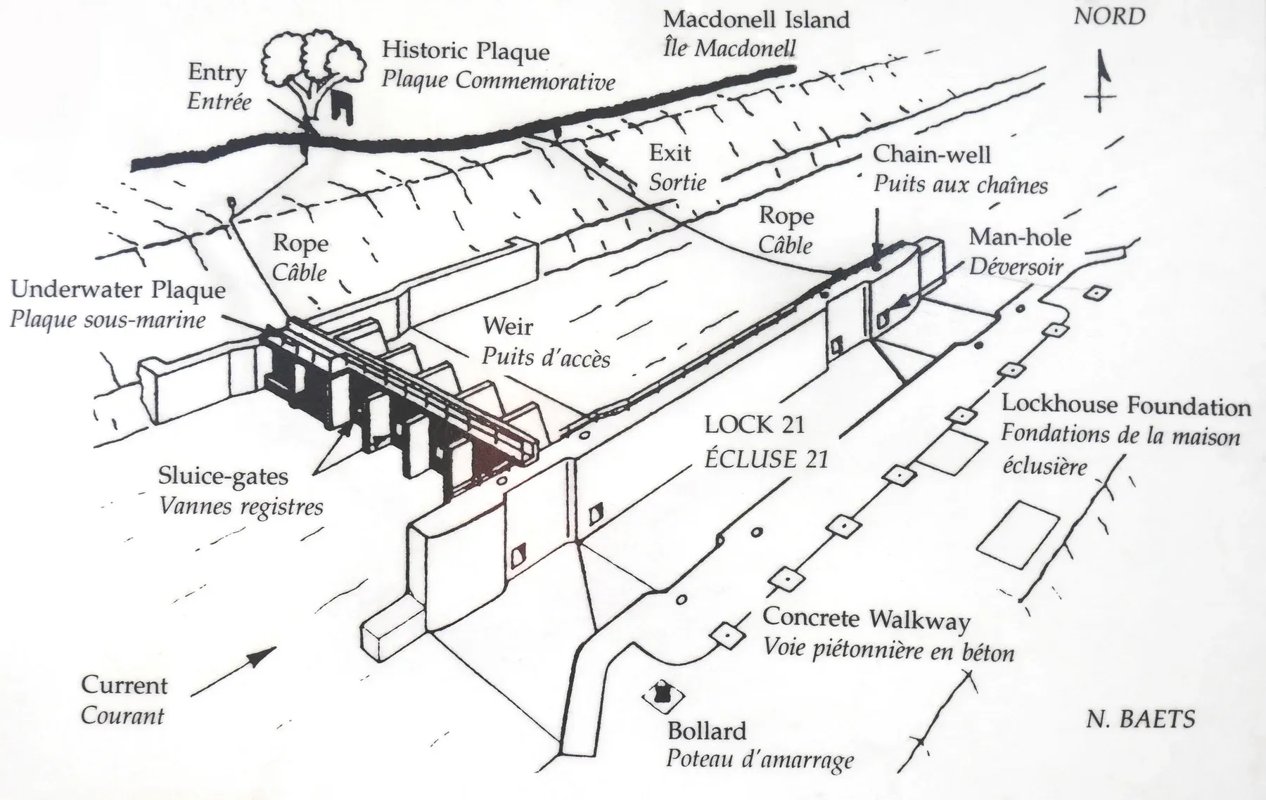
In 1988 and 1989, Nick Baets and the Ottawa chapter of Save Ontario Shipwrecks dived the lock and drew it. His 1988 drawing is the basis of the site zones.
To learn more
Section titled “To learn more”- Dickinson’s Landing, Lost Villages Historical Society: the village’s history, its stagecoaches, boats and canal
- Lost Villages of the St. Lawrence, Ontario Heritage Trust
- Cornwall Canal and Dickinson’s Landing, Wikipedia
- Save Ontario Shipwrecks, Ottawa chapter